SIOUX FALLS, S.D. (KELO) — September can feature some of the most beautiful weather of the year in the northern plains. But too much mild and dry weather is not good news for parts of western KELOLAND.
September can still be a hot month at times, but it also is noted for the first installments of stronger cold fronts as we approach the official start of fall. Those 2 talking points will be big features we see ahead.
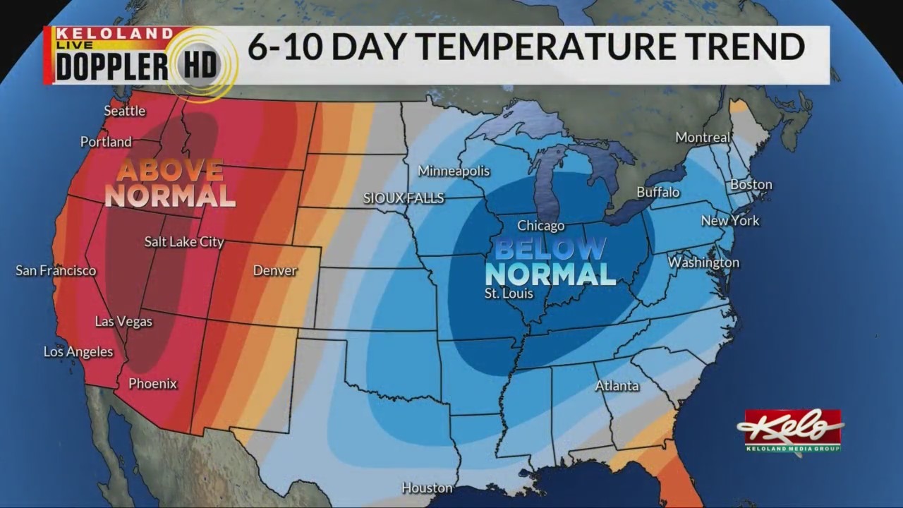
Just take a look at the latest 6-10 day forecast.

Notice all the heat to our northwest. Also, you can see chances for below normal temperatures to the east of KELOLAND. This type of pattern will likely repeat this month, so KELOLAND will be caught in between where temperatures will swing back and forth, similar to short-term forecasting we are observing this week.
The overall average temperature trend for September will likely be warmer than average across the northern plains and much of the nation.
We also expect the month to trend drier than normal, with hurricane activity holding the only wild card to our south.
Since this is not a wet weather pattern for KELOLAND, fire weather concerns in western KELOLAND will likely flare up again. We’ll have a closer look at that story Wednesday.