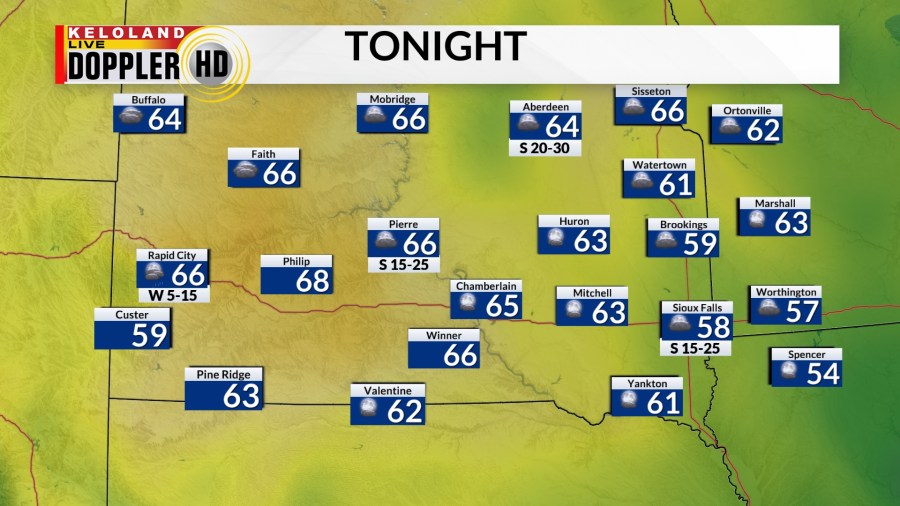
SIOUX FALLS, S.D. (KELO) — After another hot day Tuesday, we’ll slowly cool things off as we introduce a chance for showers and thunderstorms in western South Dakota tonight.

The rain will not make it into eastern KELOLAND, so expect partly cloudy conditions in the east. With strong south winds, expect temperatures to fall to the 60s for many.

A cold front will slowly creep to the east as we go through the day tomorrow. Along with it, we’ll watch for our chances of showers and thunderstorms. Temperatures will reach the 80s for afternoon highs. Expect strong south winds ahead of the front, but winds will become west to northwest behind the front. The northwest winds will help bring in cooler weather for the rest of the week.

Isolated storms may become strong to severe as the Storm Prediction Center has a marginal risk for severe weather tomorrow covering all of KELOLAND.

Eastern and southeastern KELOLAND has the best chance of getting rain Wednesday night. Isolated rain will be possible EARLY Thursday morning, then expect clearing skies and cooler temperatures.

The weekend is looking cool and dry. There will be a taste of fall in the air as lows fall to the 40s and afternoon highs hit the lower 70s.