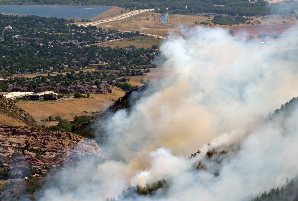
Colorado wildfire updates for Wednesday, Aug. 7, 2024
Fire crews across the state Wednesday continued to gain or hold containment lines on the three remaining active wildfires.
Since July 29, wildfires in Larimer, Boulder, Montrose and Jefferson counties have killed one person, damaged or destroyed more than 50 buildings, evacuated thousands of people and charred approximately 15,000 acres.
Fire crews nearly doubled containment on the Quarry fire in Jefferson County Tuesday, growing from 45% in the morning to 82% that afternoon. Containment of the Alexander Mountain fire also passed 80% on Tuesday.
The remaining wildfire — the Bucktail fire in Montrose County — continues to grow on national forest land as fire crews fight to secure fire lines around it.
The Lake Shore fire in Boulder County was completely extinguished last week, and Boulder County officials announced Sunday that fire crews had fully contained the Stone Canyon fire. Flames could continue to burn in the contained area for days or weeks.
Click here to skip to a specific fire: Quarry fire | Alexander Mountain fire | Bucktail fire | Wildfire map

Quarry fire near Deer Creek Canyon
- Access the latest evacuation map here
Last updated at 6:45 a.m.
The Quarry fire burning on more than 500 acres in Jefferson County was 82% contained Tuesday night, and the fire lines continued to hold Wednesday.
The 578-acre fire, which forced nearly 600 homes to evacuate after it started burning late July 30, has not destroyed any structures, fire officials said. .
All mandatory evacuations for the Quarry fire burning in Jefferson County were lifted at 10 a.m. Tuesday morning, sheriff’s officials said.
Residents can go home but must pick up their access credentials at the Dakota Ridge High School evacuation center before they’ll be able to enter their neighborhoods, according to the Jefferson County Sheriff’s Office.
“Current mandatory evacuation neighborhoods will be moved to pre-evacuation status,” sheriff’s officials said in the Tuesday morning update. “Current pre-evacuation neighborhoods will be moved to non-status.”
Only residents with access cards will be allowed into the previously evacuated area for the next until Thursday, sheriff’s officials said. Deer Creek Canyon Road will remain closed between Grizzly Drive and Phillipsburg as fire crews clean up.
The evacuation center permanently closed at 6 p.m. Tuesday, sheriff’s officials said.
“The large animal evacuation site at Jeffco Fairgrounds asks that those no longer in pre-evacuation status make arrangements to pick up their animals,” sheriff’s officials stated Tuesday. “If you are now in pre-evacuation you may keep your animals at the fairgrounds until your status has changed.”
No details about the ongoing arson investigation were available Wednesday morning. Anyone with information about how the fire started can call the Quarry fire Tip Line at 303-271-5612.

Alexander Mountain fire near Loveland
- Access the latest evacuation map here
Last updated at 6:40 a.m.
Fire crews gained 83% containment on the 9,668-ace Alexander Mountain fire Monday, and the lines continued to hold Wednesday.
The fire, which sparked on July 29, is burning in the Roosevelt National Forest and on private land 10 miles west of Loveland.
As of Wednesday, 26 homes and 21 outbuildings had been destroyed in the Storm Mountain and Cedar Park areas, and four more homes were damaged.
Larimer County Sheriff John Feyen said it’s possible that more damaged or destroyed structures will be found, and the Larimer County Office of Emergency Management has contacted people with known damage to structures to provide resources and next steps.
The cause of the wildfire remains under investigation Wednesday. Feyen said Monday that investigators found signs of human activity and multiple lightning strikes near where the fire started.
Command of the fire will transition from the Southwest Incident Management Team back to the US Forest Service and Larimer County Sheriff’s Office on Friday at 6 a.m., fire officials said in a Tuesday night update.
“Community members may see smoke and smoldering fire activity in the burn area, but the perimeter is not expected to expand,” officials said in the update.
As of Tuesday night, mandatory evacuation orders had been lifted for the area along County Road 43 west of Drake to Old Bridge Road, as well as Waltonia Road. The area is now under voluntary evacuation orders, according to the evacuation map.
Fire officials said residents in these areas will need to access their homes or properties from Estes Park as U.S. 34 remains closed west of Idlewild to Waltonia.
The rough boundaries of the mandatory evacuation zone Wednesday morning include Storm Mountain to the north, U.S. 34 to the east, Sheep Mountain to the south and Bobcat Ridge Natural area to the west.
Anyone with information can call the Forest Service Law Enforcement Tip Line at 303-275-5266.

