SIOUX FALLS, S.D. (KELO) — Notice the smoke in the air? We have been following wildfire smoke and our own fire danger here in KELOLAND.
Hazy sunshine due to wildfire smoke to our west will continue across much of the upper plains, including us in the eastern section of the state. And parts of South Dakota will have their own fire danger to worry about.
It was a hot summer day today with highs in the 80s, 90s, and 100s. The 100-degree heat will be in western South Dakota where Red Flag Warnings were issued due to high fire danger. But we already have fires burning to our west, and those fires will continue to throw smoke into the skies over KELOLAND.

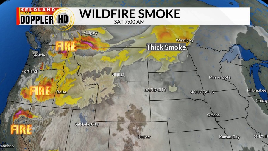
You can see where the fires are on this graphic. Notice when we go through time, the upper-level winds move the smoke plumes move east. By the beginning of the weekend, we’ll watch for thicker smoke to our north in North Dakota.
And there’s very little relief in the forecast. As you can see here, mostly dry skies will continue for those areas to our west for the next 10 days.
The same will hold true for many in KELOLAND. Through the rest of this month and into next month will feature mostly dry skies we cannot rule out isolated storms in eastern South Dakota as humidity will be thicker. But any way you look at it, expect more summertime heat with hazy skies for at least the next couple of weeks.