SIOUX FALLS, S.D. (KELO) — Though we will have some heavy rain expected this holiday weekend we’ll explain why we shouldn’t worry too much about it.
There will be periods of rain again in southeasteastern KELOLAND Tuesday. While there’s more rain on the way for the Fourth of July holiday, widespread heavy rain shouldn’t be a threat.
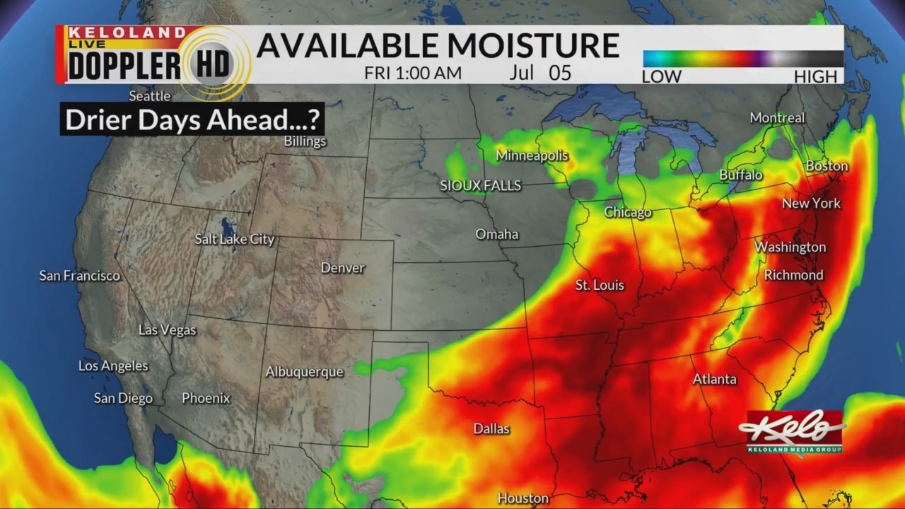
One way we determine if heavy rain is in the forecast is by a product called precipitable water. It measures the depth of the water in the atmosphere at different points. In theory, it’s a measure of how much rain will fall if all the water vapor condenses and falls as rain.
This graphic shows where there is high precipitable water in red and purple. Notice that after the Fourth of July, the highest values are moved south. Don’t get me wrong, there will be chances for rain, but widespread heavy rain will not be common.

Something else to take away from that graphic is as the water gets pushed to the south, cooler than average air will overtake the northern plains. But that should be short-lived, and we’ll warm closer to average or above average around the middle of the month.