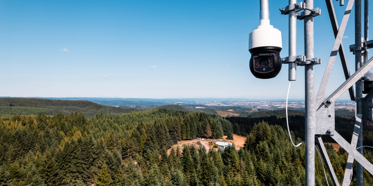
When blazes are confirmed, Pano alerts fire monitoring agencies, providing images and location data that help them respond quickly.
As firefighters battle the blaze, the company continues to provide up-to-date, highly zoomable images of the shifting conditions, along with satellite imagery, weather information, and additional data feeds assembled from other sources.
Key indicators
- Industry: Wildfire detection
- Founded: 2020
- Headquarters: San Francisco, California, USA
- Notable fact: Pano is helping several agencies monitor and control flames that wildfire specialists intentionally set to clear out brush and reduce risks in forests and grasslands, standing ready to send the alert if the fire should break out beyond the designated boundaries.
Potential for impact
The risks of devastating wildfires are growing, in part because we continue to build communities on the edge of wildlands, many of which we’ve allowed to become overgrown. Meanwhile, climate change is also making many areas hotter and drier, turning trees, shrubs, and grasses into kindling.
As the economic and human toll of fire rises, it’s become increasingly critical to develop better ways to prevent or extinguish them before they turn into conflagrations.
Typically, emergency responders rely on people to spot smoke or fires and report them. But in the time it takes agencies to verify those reports, tiny fires can grow into massive blazes that become far more destructive and much harder to put out.
The promise of Pano is that it can dramatically shorten that response time by spotting, confirming, and pinpointing the location of fires that might not be visible to humans for hours, because they are in remote areas or below tree cover, or ignited at night. That should reduce the number of uncontrollable fires as well as the death and damage they cause.