SIOUX FALLS, S.D. (KELO) — Several areas of KELOLAND are still in recovery after severe storms rolled through the region towards the end of July and the beginning of August.
We will look at our severe weather numbers in South Dakota so far this year.
Much of KELOLAND is getting a break from the heat and humidity as well as severe weather. But we are about on pace when it come to total severe weather reports.
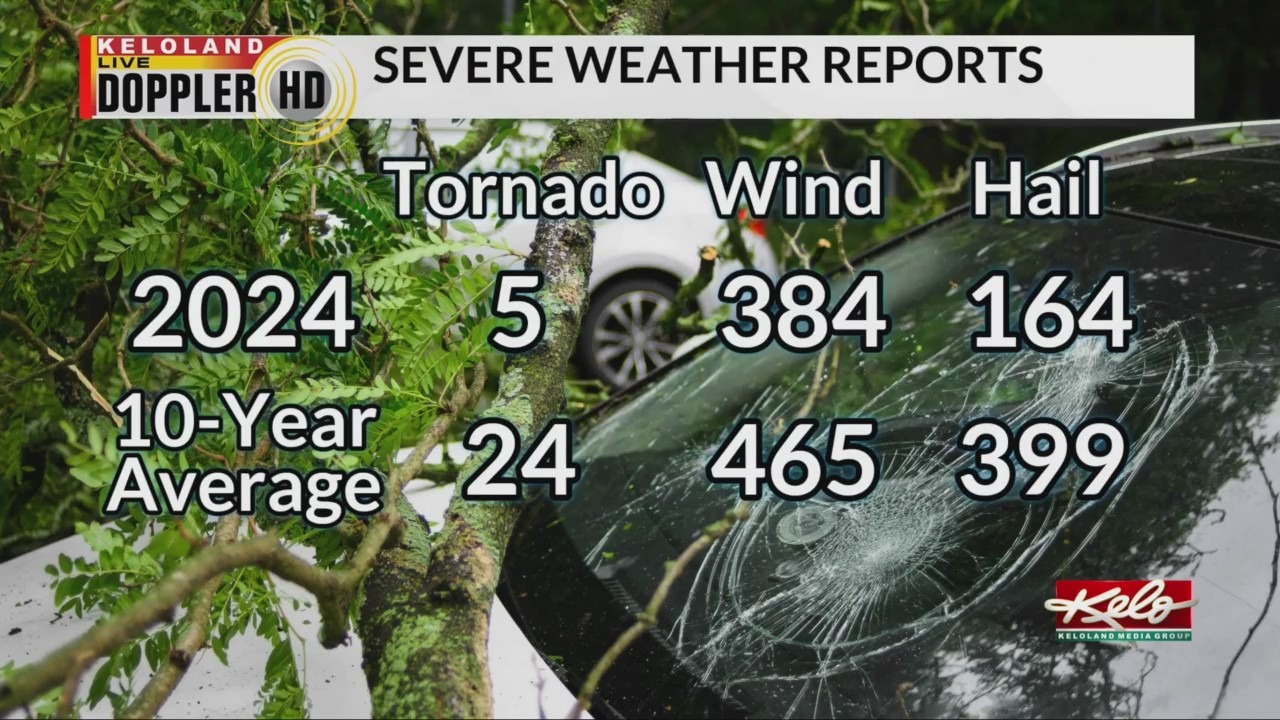
Here’s a look at our severe weather reports this year compared to the ten-year average.
Tornadoes are at five, severe wind reports are at 384 and severe hail reports are at 164. All these reports add up to 553.

When you compare the total reports to average, South Dakota is at 62% of its yearly average for the past 10 years.
Historically, we usually see severe weather decrease as we go through the month of August. But I have noticed an up tick in severe weather during the second half of August, which is when I expect temperatures to return above average. We’ll see if a more active severe weather pattern occurs at the same time.
While we do get severe weather with cooler than average temperatures, such as the highs in the 70s for the rest of the week, severe weather can still occur. It’s just harder to get more numerous severe storms.